
| ||||||||||||||||||||||||||||
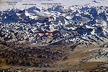
 Location on Earth | ||||||||||||||||||||||||||||
 | ||||||||||||||||||||||||||||


In 1856, the Great Trigonometric Survey of India established the first published height of Everest, then known as Peak XV, at 29,002 ft (8,840 m). In 1865, Everest was given its official English name by the Royal Geographical Society upon recommendation of Andrew Waugh, the British Surveyor General of India at the time. Chomolungma had been in common use by Tibetans for centuries, but Waugh was unable to propose an established local name because Nepal and Tibet were closed to foreigners.
The highest mountain in the world attracts climbers of all levels, from well experienced mountaineers to novice climbers willing to pay substantial sums to professional mountain guides to complete a successful climb. The mountain, while not posing substantial technical climbing difficulty on the standard route (other eight-thousanders such as K2 or Nanga Parbat are much more difficult), still has many inherent dangers such as altitude sickness, weather and wind. By the end of the 2008 climbing season, there had been 4,102 ascents to the summit by about 2,700 individuals.[4] Climbers are a significant source of tourist revenue for Nepal, whose government also requires all prospective climbers to obtain an expensive permit, costing up to US $ 25,000 per person.[5] Everest has claimed 210 lives, including eight who perished during a 1996 storm high on the mountain. Conditions are so difficult in the death zone that most corpses have been left where they fell. Some of them are visible from standard climbing routes.[6]
Identifying the highest mountain
In 1808, the British began the Great Trigonometric Survey of India to determine the location and names of the world's highest mountains. Starting in southern India, the survey teams gradually moved northward using giant 500 kg (1,100 lb) theodolites (each requiring 12 men to carry) to measure heights as accurately as possible. They reached the Himalayan foothills by the 1830s, but Nepal was unwilling to allow the British to enter the country because of suspicions of political aggression and possible annexation. Several requests by the surveyors to enter Nepal were turned down.[7]The British were forced to continue their observations from Terai, a region south of Nepal which is parallel to the Himalayas. Conditions in Terai were difficult owing to torrential rains and malaria — three survey officers died from malaria while two others had to retire owing to failing health.[7]
Nonetheless, in 1847, the British pressed on and began detailed observations of the Himalayan peaks from observation stations up to 240 km (150 mi) away. Weather restricted work to the last three months of the year. In November 1847, Andrew Waugh, the British Surveyor General of India made a number of observations from Sawajpore station located in the eastern end of the Himalayas. At the time, Kangchenjunga was considered the highest peak in the world, and with interest he noted a peak beyond it, some 230 km (140 mi) away. John Armstrong, one of Waugh's officials, also saw the peak from a location further west and called it peak 'b'. Waugh would later write that the observations indicated that peak 'b' was higher than Kangchenjunga, but given the great distance of the observations, closer observations were required for verification. The following year, Waugh sent a survey official back to Terai to make closer observations of peak 'b', but clouds thwarted all attempts.[7]
In 1849, Waugh dispatched James Nicolson to the area. Nicolson was able to make two observations from Jirol, 190 km (120 mi) away. Nicolson then took the largest theodolite and headed east, obtaining over 30 observations from five different locations, with the closest being 174 km (108 mi) away from the peak.[7]
Nicolson retreated to Patna on the Ganges to perform the necessary calculations based on his observations. His raw data gave an average height of 9,200 m (30,200 ft) for peak 'b', but this did not take into account light refraction which distorts heights. The number clearly indicated, however, that peak 'b' was higher than Kangchenjunga. Unfortunately, Nicolson came down with malaria and was forced to return home, calculations unfinished. Michael Hennessy, one of Waugh's assistants, had begun designating peaks based on roman numerals, with Kangchenjunga named Peak IX, while peak 'b' now became known as Peak XV.[7]
In 1852, stationed at the survey's headquarters in Dehradun, Radhanath Sikdar, an Indian mathematician and surveyor from Bengal, was the first to identify Everest as the world's highest peak, using trigonometric calculations based on Nicolson's measurements.[8] An official announcement that Peak XV was the highest was delayed for several years as the calculations were repeatedly verified. Waugh began work on Nicolson's data in 1854, and along with his staff spent almost two years working on the calculations, having to deal with the problems of light refraction, barometric pressure, and temperature over the vast distances of the observations. Finally, in March 1856 he announced his findings in a letter to his deputy in Kolkata. Kangchenjunga was declared to be 28,156 ft (8,582 m), while Peak XV was given the height of 29,002 ft (8,840 m). Waugh concluded that Peak XV was "most probably the highest in the world".[7] In fact, Peak XV (measured in feet) was calculated to be exactly 29,000 ft (8,839.2 m) high, but was publicly declared to be 29,002 ft (8,839.8 m). The arbitrary addition of 2 ft (61 cm) was to avoid the impression that an exact height of 29,000 feet (8,839.2 m) was nothing more than a rounded estimate.[9]
Naming
With the height now established, what to name the peak was clearly the next challenge. While the survey was anxious to preserve local names if possible (e.g. Kangchenjunga and Dhaulagiri) Waugh argued that he was unable to find any commonly used local name. Waugh's search for a local name was hampered by Nepal and Tibet being closed to foreigners at the time. Many local names existed, with perhaps the best known in Tibet for several centuries being Chomolungma, which had appeared on a 1733 map published in Paris by the French geographer D'Anville. However, Waugh argued that with the plethora of local names, it would be difficult to favour one specific name over all others. So, he decided that Peak XV should be named after George Everest, his predecessor as Surveyor General of India.[7][10] He wrote:I was taught by my respected chief and predecessor, Colonel Sir George Everest to assign to every geographical object its true local or native appellation. But here is a mountain, most probably the highest in the world, without any local name that we can discover, whose native appellation, if it has any, will not very likely be ascertained before we are allowed to penetrate into Nepal. In the meantime the privilege as well as the duty devolves on me to assign…a name whereby it may be known among citizens and geographers and become a household word among civilized nations.[11]George Everest opposed the name suggested by Waugh and told the Royal Geographical Society in 1857 that Everest could not be written in Hindi nor pronounced by "the native of India". Waugh's proposed name prevailed despite the objections, and in 1865, the Royal Geographical Society officially adopted Mount Everest as the name for the highest mountain in the world.[7] Interestingly, the modern pronunciation of Everest /ˈɛvərɨst, ˈɛvrɨst/[12] is in fact different from Sir George's pronunciation of his surname, which was /ˈiːvrɨst/.[13]

In the late 19th century, many European cartographers incorrectly believed that a native name for the mountain was Gaurisankar.[15] This was a result of confusion of Mount Everest with the actual Gauri Sankar, which, when viewed from Kathmandu, stands almost directly in front of Everest.[citation needed]
In the early 1960s, the Nepalese government gave Mount Everest the official name Sagarmāthā (सगरमाथा).[16] This name had not previously been used; the local inhabitants knew the mountain as Chomolungma. The mountain was not known and named in ethnic Nepal (that is, the Kathmandu valley and surrounding areas).[citation needed] The government set out to find a Nepalese name for the mountain because the Sherpa/Tibetan name Chomolangma was not acceptable, as it would have been against the idea of unification (Nepalization) of the country.[citation needed]
In 2002, the Chinese People's Daily newspaper published an article making a case against the continued use of the English name for the mountain in the Western world, insisting that it should be referred to by its Tibetan name. The newspaper argued that the Chinese (in nature a Tibetan) name preceded the English one, as Mount Qomolangma was marked on a Chinese map more than 280 years ago.[17]
Measurement
In 1856, Andrew Waugh announced Everest (then known as Peak XV) as 29,002 ft high, after several years of calculations based on observations made by the Great Trigonometric Survey.
More recently, the mountain has been found to be 8,848 m (29,029 ft) high, although there is some variation in the measurements. On 9 October 2005, after several months of measurement and calculation, the PRC's State Bureau of Surveying and Mapping officially announced the height of Everest as 8,844.43 m (29,017.16 ft) with accuracy of ±0.21 m (0.69 ft). They claimed it was the most accurate and precise measurement to date.[18] This height is based on the actual highest point of rock and not on the snow and ice covering it. The Chinese team also measured a snow/ice depth of 3.5 m (11 ft),[19] which is in agreement with a net elevation of 8,848 m (29,029 ft). The snow and ice thickness varies over time, making a definitive height of the snow cap impossible to determine.
The elevation of 8,848 m (29,029 ft) was first determined by an Indian survey in 1955, made closer to the mountain, also using theodolites. It was subsequently reaffirmed by a 1975 Chinese measurement.[19] In both cases the snow cap, not the rock head, was measured. In May 1999 an American Everest Expedition, directed by Bradford Washburn, anchored a GPS unit into the highest bedrock. A rock head elevation of 8,850 m (29,035 ft), and a snow/ice elevation 1 m (3 ft) higher, were obtained via this device.[20] Although it has not been officially recognized by Nepal,[21] this figure is widely quoted. Geoid uncertainty casts doubt upon the accuracy claimed by both the 1999 and 2005 surveys.
A detailed photogrammetric map (at a scale of 1:50,000) of the Khumbu region, including the south side of Mount Everest, was made by Erwin Schneider as part of the 1955 International Himalayan Expedition, which also attempted Lhotse. An even more detailed topographic map of the Everest area was made in the late 1980s under the direction of Bradford Washburn, using extensive aerial photography.[22]
It is thought that the plate tectonics of the area are adding to the height and moving the summit northeastwards. Two accounts suggest the rates of change are 4 mm (0.16 in) per year (upwards) and 3 to 6 mm (0.12 to 0.24 in) per year (northeastwards),[20][23] but another account mentions more lateral movement (27 mm/1.1 in),[24] and even shrinkage has been suggested.[25]
Comparisons
The summit of Everest is the point at which the earth's surface reaches the greatest distance above sea level. Several other mountains are sometimes claimed as alternative "tallest mountains on Earth". Mauna Kea in Hawaii is tallest when measured from its base;[26] it rises over 10,200 m (6.3 mi) when measured from its base on the mid-ocean floor, but only attains 4,205 m (13,796 ft) above sea level.By the same measure of base[26] to summit, Mount McKinley, in Alaska, is also taller than Everest. Despite its height above sea level of only 6,193.6 m (20,320 ft), Mount McKinley sits atop a sloping plain with elevations from 300 m (980 ft) to 900 m (3,000 ft), yielding a height above base in the range of 5,300 to 5,900 m (17,400 to 19,400 ft); a commonly quoted figure is 5,600 m (18,400 ft).[27] By comparison, reasonable base elevations for Everest range from 4,200 m (13,800 ft) on the south side to 5,200 m (17,100 ft) on the Tibetan Plateau, yielding a height above base in the range of 3,650 to 4,650 m (11,980 to 15,260 ft).[22]
The summit of Chimborazo in Ecuador is 2,168 m (7,113 ft) farther from the Earth's centre (6,384.4 km (3,967.1 mi)) than that of Everest (6,382.3 km (3,965.8 mi)), because the Earth bulges at the Equator. However, Chimborazo attains a height of only 6,267 m (20,561 ft) above sea level, and by this criterion it is not even the highest peak of the Andes.
Climbing routes
 |
Southeast ridge
The ascent via the southeast ridge begins with a trek to Base Camp at 5,380 m (17,700 ft) on the south side of Everest in Nepal. Expeditions usually fly into Lukla (2,860 m) from Kathmandu and pass through Namche Bazaar. Climbers then hike to Base Camp, which usually takes six to eight days, allowing for proper altitude acclimatization in order to prevent altitude sickness.[32] Climbing equipment and supplies are carried by yaks, dzopkyos (yak hybrids) and human porters to Base Camp on the Khumbu Glacier. When Hillary and Tenzing climbed Everest in 1953, they started from Kathmandu Valley, as there were no roads further east at that time.Climbers will spend a couple of weeks in Base Camp, acclimatizing to the altitude. During that time, Sherpas and some expedition climbers will set up ropes and ladders in the treacherous Khumbu Icefall. Seracs, crevasses and shifting blocks of ice make the icefall one of the most dangerous sections of the route. Many climbers and Sherpas have been killed in this section. To reduce the hazard, climbers will usually begin their ascent well before dawn when the freezing temperatures glue ice blocks in place. Above the icefall is Camp I at 6,065 metres (19,900 ft).
From Camp I, climbers make their way up the Western Cwm to the base of the Lhotse face, where Camp II or Advanced Base Camp (ABC) is established at 6,500 m (21,300 ft). The Western Cwm is a relatively flat, gently rising glacial valley, marked by huge lateral crevasses in the centre which prevent direct access to the upper reaches of the Cwm. Climbers are forced to cross on the far right near the base of Nuptse to a small passageway known as the "Nuptse corner". The Western Cwm is also called the "Valley of Silence" as the topography of the area generally cuts off wind from the climbing route. The high altitude and a clear, windless day can make the Western Cwm unbearably hot for climbers.[33]
From ABC, climbers ascend the Lhotse face on fixed ropes up to Camp III, located on a small ledge at 7,470 m (24,500 ft). From there, it is another 500 metres to Camp IV on the South Col at 7,920 m (26,000 ft). From Camp III to Camp IV, climbers are faced with two additional challenges: The Geneva Spur and The Yellow Band. The Geneva Spur is an anvil shaped rib of black rock named by a 1952 Swiss expedition. Fixed ropes assist climbers in scrambling over this snow covered rock band. The Yellow Band is a section of interlayered marble, phyllite, and semischist which also requires about 100 metres of rope for traversing it.[33]
On the South Col, climbers enter the death zone. Climbers typically only have a maximum of two or three days they can endure at this altitude for making summit bids. Clear weather and low winds are critical factors in deciding whether to make a summit attempt. If weather does not cooperate within these short few days, climbers are forced to descend, many all the way back down to Base Camp.
From the South Summit, climbers follow the knife-edge southeast ridge along what is known as the "Cornice traverse" where snow clings to intermittent rock. This is the most exposed section of the climb as a misstep to the left would send one 2,400 m (8,000 ft) down the southwest face while to the immediate right is the 3,050 m (10,000 ft) Kangshung face. At the end of this traverse is an imposing 12 m (40 ft) rock wall called the "Hillary Step" at 8,760 m (28,740 ft).[33]
Hillary and Tenzing were the first climbers to ascend this step and they did it with primitive ice climbing equipment and with ropes. Nowadays, climbers will ascend this step using fixed ropes previously set up by Sherpas. Once above the step, it is a comparatively easy climb to the top on moderately angled snow slopes - though the exposure on the ridge is extreme especially while traversing very large cornices of snow. With increasing numbers of people climbing the mountain in recent years, the Step has frequently become a bottleneck, with climbers forced to wait significant amounts of time for their turn on the ropes, leading to problems in getting climbers efficiently up and down the mountain. After the Hillary Step, climbers also must traverse a very loose and rocky section that has a very large entanglement of fixed ropes that can be troublesome in bad weather. Climbers will typically spend less than a half-hour on the "top of the world" as they realize the need to descend to Camp IV before darkness sets in, afternoon weather becomes a serious problem, or supplemental oxygen tanks run out.
Northeast ridge
The northeast ridge route begins from the north side of Everest in Tibet. Expeditions trek to the Rongbuk Glacier, setting up Base Camp at 5,180 m (16,990 ft) on a gravel plain just below the glacier. To reach Camp II, climbers ascend the medial moraine of the east Rongbuk Glacier up to the base of Changtse at around 6,100 m (20,000 ft). Camp III (ABC - Advanced Base Camp) is situated below the North Col at 6,500 m (21,300 ft). To reach Camp IV on the north col, climbers ascend the glacier to the foot of the col where fixed ropes are used to reach the North Col at 7,010 m (23,000 ft). From the North Col, climbers ascend the rocky north ridge to set up Camp V at around 7,775 m (25,500 ft). The route crosses the North Face in a diagonal climb to the base of the Yellow Band reaching the site of Camp VI at 8,230 m (27,000 ft). From Camp VI, climbers will make their final summit push. Climbers face a treacherous traverse from the base of the First Step: 27,890 feet - 28,000 feet, to the crux of the climb, the Second Step: 28,140 feet - 28,300 feet. (The Second Step includes a climbing aid called the "Chinese ladder", a metal ladder placed semi-permanently in 1975 by a party of Chinese climbers. It has been almost continuously in place since, and ladders have been used by virtually all climbers on the route.) Once above the Second Step the inconsequential Third Step is clambered over: 28,510 feet - 28,870 feet. Once above these steps, the summit pyramid is climbed by means of a snow slope of 50 degrees, to the final summit ridge along which the top is reached.[34]
Ascents
Main article: Timeline of climbing Mount Everest
Early expeditions

The northern approach to the mountain was discovered by George Mallory on the first expedition in 1921. It was an exploratory expedition not equipped for a serious attempt to climb the mountain. With Mallory leading (and thus becoming the first European to set foot on Everest's flanks) they climbed the North Col 7,007 metres (22,989 ft). From there, Mallory espied a route to the top, but the party was unprepared for the great task of climbing any further and descended.
The British returned for a 1922 expedition. George Finch ("The other George") climbed using oxygen for the first time. He ascended at a remarkable speed — 950 feet (290 m) per hour, and reached an altitude of 8,320 m (27,300 ft), the first time a human climbed higher than 8,000m. This feat was entirely lost on the British climbing establishment — except for its "unsporting" nature. Mallory and Col. Felix Norton made a second unsuccessful attempt. Mallory was faulted for leading a group down from the North Col which got caught in an avalanche. Mallory was pulled down too, but seven native porters were killed.
The next Expedition was in 1924. The initial attempt by Mallory and Bruce, was aborted when weather conditions precluded the establishment of Camp VI. The next attempt was that of Norton and Somervell who climbed without oxygen and in perfect weather, traversing the North Face into the Great Couloir. Norton managed to reach 8,558 metres (28,077 ft), though he ascended only 100 feet (30 m) or so in the last hour. Mallory rustled up oxygen equipment for a last-ditch effort. He chose the young Andrew Irvine as his partner.
On 8 June 1924 George Mallory and Andrew Irvine made an attempt on the summit via the North Col/North Ridge/Northeast Ridge route from which they never returned. On 1 May 1999 the Mallory and Irvine Research Expedition found Mallory's body on the North Face in a snow basin below and to the west of the traditional site of Camp VI. Controversy has raged in the mountaineering community as to whether or not one or both of them reached the summit 29 years before the confirmed ascent (and of course, safe descent) of Everest by Sir Edmund Hillary and Tenzing Norgay in 1953.
In 1933, Lady Houston, a British millionaire ex-showgirl, funded the Houston Everest Flight of 1933, which saw a formation of aircraft led by the Marquess of Clydesdale fly over the summit in an effort to deploy the British Union Flag at the top.[36][37]
Early expeditions — such as Bruce's in the 1920s and Hugh Ruttledge's two unsuccessful attempts in 1933 and 1936 — tried to make an ascent of the mountain from Tibet, via the north face. Access was closed from the north to western expeditions in 1950, after the Chinese asserted control over Tibet. In 1950, Bill Tilman and a small party which included Charles Houston, Oscar Houston and Betsy Cowles undertook an exploratory expedition to Everest through Nepal along the route which has now become the standard approach to Everest from the south.[38]
In the spring of 1952 a Swiss expedition, lead by Edouard Wyss-Dunant was granted permission to attempt a climb from Nepal. The expedition established a route through the Khumbu ice fall and ascended to the South Col at an elevation of 7,986 metres (26,201 ft). Raymond Lambert and Sherpa Tenzing Norgay were able to reach a height of about 8,595 metres (28,199 ft) on the southeast ridge, setting a new climbing altitude record. Tenzing's experience was useful when he was hired to be part of the British expedition in 1953.[39]
First successful ascent by Tenzing and Hillary
In 1953, a ninth British expedition, led by John Hunt, returned to Nepal. Hunt selected two climbing pairs to attempt to reach the summit. The first pair (Tom Bourdillon and Charles Evans) came within 100 m (300 feet) of the summit on 26 May 1953, but turned back after becoming exhausted. As planned, their work in route finding and breaking trail and their caches of extra oxygen were of great aid to the following pair. Two days later, the expedition made its second and final assault on the summit with its second climbing pair, the New Zealander Edmund Hillary and Tenzing Norgay, a sherpa climber from India and Nepal. They reached the summit at 11:30 a.m. local time on 29 May 1953 via the South Col Route. At the time, both acknowledged it as a team effort by the whole expedition, but Tenzing revealed a few years later that Hillary had put his foot on the summit first.[40] They paused at the summit to take photographs and buried a few sweets and a small cross in the snow before descending.News of the expedition's success reached London on the morning of Queen Elizabeth II's coronation, June 2. Returning to Kathmandu a few days later, Hunt (a Briton) and Hillary (a subject of Elizabeth, through her role as head of state of New Zealand) discovered that they had been promptly knighted in the Order of the British Empire, a KBE, for the ascent. Tenzing (a subject of the King of Nepal) was granted the George Medal by the UK. Hunt was ultimately made a life peer in Britain, while Hillary became a founding member of the Order of New Zealand.
First ascents without supplemental oxygen
On 8 May 1978, Reinhold Messner (Italy) and Peter Habeler (Austria) made the first ascent without supplemental oxygen, using the southeast ridge route.[28][41] On 20 August 1980, Messner reached the summit of the mountain solo for the first time, without supplementary oxygen or support, on the more difficult Northwest route via the North Col to the North Face and the Great Couloir. He climbed for three days entirely alone from his base camp at 6,500 metres (21,300 ft).[28]First Winter Ascent
In 1980, a team from Poland led by Andrzej Zawada, Leszek Cichy, and Krzysztof Wielicki became the first to reach the summit during the winter season.1996 disaster
Main article: 1996 Everest disaster
During the 1996 climbing season, fifteen people died trying to come down from the summit, making it the deadliest single year in Everest history. Eight of them died on 11 May alone. The disaster gained wide publicity and raised questions about the commercialization of Everest.Journalist Jon Krakauer, on assignment from Outside magazine, was in one of the affected parties, and afterwards published the bestseller Into Thin Air, which related his experience. Anatoli Boukreev, a guide who felt impugned by Krakauer's book, co-authored a rebuttal book called The Climb. The dispute sparked a large debate within the climbing community. In May 2004, Kent Moore, a physicist, and John L. Semple, a surgeon, both researchers from the University of Toronto, told New Scientist magazine that an analysis of weather conditions on 11 May suggested that freak weather caused oxygen levels to plunge approximately 14%.[42][43]
The storm's impact on climbers on the mountain's other side, the North Ridge, where several climbers also died, was detailed in a first hand account by British filmmaker and writer Matt Dickinson in his book The Other Side of Everest.
2005: Helicopter landing
On 14 May 2005, pilot Didier Delsalle of France landed a Eurocopter AS 350 B3 helicopter on the summit of Mount Everest[44] (without any witness) and took off after about four minutes. (His rotors were continually engaged, constituting a "hover landing", and avoiding the risks of relying on the snow to support the aircraft.) He thereby set rotorcraft world records, for highest of both landing (de facto) and take-off (formally).[45]Delsalle had also performed, two days earlier, a take-off from the South Col; some press reports suggested that the report of the summit landing was a misunderstanding of a South Col one.[46]
2006: David Sharp controversy
Double-amputee climber Mark Inglis revealed in an interview with the press on 23 May 2006,[47] that his climbing party, and many others, had passed a distressed climber, David Sharp, on 15 May, sheltering under a rock overhang 450 metres below the summit, without attempting a rescue. The revelation sparked wide debate on climbing ethics, especially as applied to Everest. The climbers who left him said that the rescue efforts would have been useless and only have caused more deaths. Much of this controversy was captured by the Discovery Channel while filming the television program Everest: Beyond the Limit. A crucial decision affecting the fate of Sharp is shown in the program, where an early returning climber (Max Chaya) is descending and radios to his base camp manager (Russell Brice) that he has found a climber in distress. He is unable to identify Sharp, who had chosen to climb solo without any support and so did not identify himself to other climbers. The base camp manager assumes that Sharp is part of a group that has abandoned him, and informs his climber that there is no chance of him being able to help Sharp. As Sharp's condition deteriorates through the day and other descending climbers pass him, his opportunities for rescue diminish: his legs and feet curl from frostbite, preventing him from walking; the later descending climbers are lower on oxygen and lack the strength to offer aid; time runs out for any Sherpas to return and rescue him. Most importantly, Sharp's decision to forgo all support leaves him with no margin for recovery.As this debate raged, on 26 May, Australian climber Lincoln Hall was found alive, after being declared dead the day before. He was found by a party of four climbers (Dan Mazur, Andrew Brash, Myles Osborne and Jangbu Sherpa) who, giving up their own summit attempt, stayed with Hall and descended with him and a party of 11 Sherpas sent up to carry him down. Hall later fully recovered. Similar actions have been recorded since, including on 21 May 2007, when Canadian climber Meagan McGrath initiated the successful high-altitude rescue of Nepali Usha Bista.
2008: Summer Olympic torch summit
Main article: 2008 Summer Olympics summit of Mt. Everest
Beginning in 2007, China paved a 130 km (81 mi) dirt road from Tingri County to Everest's Tibet base camp, at a reported cost of 150 million yuan (US$19.7 million), to accommodate growing numbers of climbers on the north side of the mountain. Upon completion, China routed the 2008 Olympic Torch Relay over this road and to the summit of Everest, via the North Col route, on the way to the 2008 Summer Olympics in Beijing.[48] A China Telecom cellular tower near the Base Camp provides phone coverage all the way to the summit.[49]Various records
The youngest person to climb Mount Everest was Ming Kipa Sherpa, a 15-year-old Sherpa girl (via the northern side),[50] and the youngest non-Nepalese was 17-year-old Malibu resident Johnny Strange in May 2009.[51] Apa Sherpa holds the record for reaching the summit more times than any other person (19 times as of May 2009[update]).The fastest ascent over the northeast ridge was accomplished in 2007 by Austrian climber Christian Stangl, who needed 16h 42min for the 10 km distance from Camp III to the summit, just barely beating Italian Hans Kammerlander's record of 17 hours, accomplished in 1996. Both men climbed alone and without supplementary oxygen. The fastest oxygen-supported ascent over the southeast ridge was Nepalese Pemba Dorjie Sherpa's 2004 climb, using 8h 10min for the 17 km route. The fastest ascent without supplementary oxygen over the southeast ridge was accomplished by French Marc Batard who reached the summit in 22h 30min in 1988.[52]
The first descent on ski was accomplished in 2000 by Davo Karnicar.[53]
The oldest climber to successfully reach Mt. Everest's summit is 76-year-old Min Bahadur Sherchan, who did so 25 May 2008 from the Nepal side. Sherchan beat the previous record set in 2007 by 71 year old Katsusuke Yanagisawa.[54]
Death zone
Main article: Death zone
At the higher regions of Mount Everest, climbers seeking the summit typically spend substantial time within the "death zone" (altitudes higher than 8,000 m/26,246 ft), and face significant challenges to survival. Temperatures can dip to very low levels, resulting in frostbite of any body part exposed to the air. Since temperatures are so low, snow is well-frozen in certain areas and death by slipping and falling can also occur. High winds at these altitudes on Everest are also a potential threat to climbers. The atmospheric pressure at the top of Everest is about a third of sea level pressure, meaning there is about a third as much oxygen available to breathe as at sea level.[55]In May 2007, the Caudwell Xtreme Everest undertook a medical study of oxygen levels in human blood at extreme altitude. Over 200 volunteers climbed to Everest Base Camp where various medical tests were performed to examine blood oxygen levels. A small team also performed tests on the way to the summit.[56]
Even at base camp the low level of available oxygen had direct effect on blood oxygen saturation levels. At sea level these are usually 98% to 99%, but at base camp this fell to between 85% and 87%. Blood samples taken at the summit indicated very low levels of oxygen present. A side effect of this is a vastly increased breathing rate, from 20-30 breaths per minute to 80-90 breaths, leading to exhaustion just trying to breathe.[citation needed]
Lack of oxygen, exhaustion, extreme cold, and the dangers of the climb all contribute to the death toll. A person who is injured so he can't walk himself is in serious trouble since it is often extremely risky to try to carry someone out, and generally impractical to use a helicopter.
People who die during the climb are typically left behind. About 150 bodies have never been recovered. It is not uncommon to find corpses near the standard climbing routes.[57]
Using bottled oxygen

The use of bottled oxygen to ascend Mount Everest has been controversial. George Mallory himself described the use of such oxygen as unsportsmanlike, but he later concluded that it would be impossible to summit without it and consequently used it.[59] When Tenzing and Hillary made the first successful summit in 1953, they used bottled oxygen. For the next twenty-five years, bottled oxygen was considered standard for any successful summit.
Reinhold Messner was the first climber to break the bottled oxygen tradition and in 1978, with Peter Habeler, made the first successful climb without it. Although critics alleged that he sucked mini-bottles of oxygen - a claim that Messner denied - Messner silenced them when he summited the mountain solo, without supplemental oxygen or any porters or climbing partners, on the more difficult northwest route, in 1980.
The aftermath of the 1996 disaster further intensified the debate. Jon Krakauer's Into Thin Air (1997) expressed the author's personal criticisms of the use of bottled oxygen. Krakauer wrote that the use of bottled oxygen allowed otherwise unqualified climbers to attempt to summit, leading to dangerous situations and more deaths. The 11 May 1996 disaster was partially caused by the sheer number of climbers (34 on that day) attempting to ascend, causing bottlenecks at the Hillary Step and delaying many climbers, most of whom summited after the usual 2 p.m. turnaround time. He proposed banning bottled oxygen except for emergency cases, arguing that this would both decrease the growing pollution on Everest—many bottles have accumulated on its slopes—and keep marginally qualified climbers off the mountain.
The 1996 disaster also introduced the issue of the guide's role in using bottled oxygen.[60] Guide Anatoli Boukreev's decision not to use bottled oxygen was sharply criticized by Jon Krakauer. Boukreev's supporters (who include G. Weston DeWalt, who co-wrote The Climb) state that using bottled oxygen gives a false sense of security.[61] Krakauer and his supporters point out that, without bottled oxygen, Boukreev was unable to directly help his clients descend.[62] They state that Boukreev said that he was going down with client Martin Adams,[62] but just below the South Summit, Boukreev determines that Adams was doing fine on the descent and so descends at a faster pace, leaving Adams behind. Adams states in The Climb: "For me, it was business as usual, Anatoli's going by, and I had no problems with that."[63]

Thefts and other crimes
Some climbers have reported life-threatening thefts from supply caches. Vitor Negrete, the first Brazilian to climb Everest without oxygen and part of David Sharp's party, died during his descent, and theft from his high-altitude camp may have contributed.[64]In addition to theft, the 2008 book High Crimes by Michael Kodas describes unethical guides and Sherpas, prostitution and gambling at the Tibet Base Camp, fraud related to the sale of oxygen bottles, and climbers collecting donations under the pretense of removing trash from the mountain.[65]
Flora and fauna
Euophrys omnisuperstes, a minute black jumping spider, has been found at elevations as high as 6,700 metres (22,000 ft), possibly making it the highest confirmed non-microscopic permanent resident on Earth. It lurks in crevices and may feed on frozen insects that have been blown there by the wind. It should be noted that there is a high likelihood of microscopic life at even higher altitudes.[66] Birds, such as the Bar-headed Goose, have been seen flying at the higher altitudes of the mountain, while others, such as the Chough, have been spotted as high as the South Col (7,920 m)[67] scavenging on food, or even corpses, left by prior climbing expeditions.Geology

From its summit to the top of the Yellow Band, about 8,600 m (28,000 ft) above sea level, the top of Mount Everest consists of the Qomolangma Formation, which has also been designated as either the Everest Formation or Jolmo Lungama Formation. It consists of grayish to dark gray or white, parallel laminated and bedded, Ordovician limestone interlayered with subordinate beds of recrystallized dolomite with argillaceous laminae and siltstone. Gansser first reported finding microscopic fragments of crinoids in these limestones.[70] Later petrographic analysis of samples of the limestones from near the summit revealed them to be composed of carbonate pellets and finely fragmented remains of trilobites, crinoids, and ostracods. Other samples were so badly sheared and recrystallized that their original constituents could not be determined. A thick, white-weathering thrombolite bed that is 60 m (200 ft) thick comprises the foot of the "Third Step," and base of the summit pyramid of Everest. This bed, which crops out starting about 70 m (300 ft) below the summit of Mount Everest, consists of sediments trapped, bound, and cemented by the biofilms of microorganisms, especially cyanobacteria, in shallow marine waters. The Qomolangma Formation is broken up by several high-angle faults that terminate at the low angle thrust fault, the Qomolangma Detachment. This detachment separates it from the underlying Yellow Band. The lower five metres of the Qomolangma Formation overlying this detachment are very highly deformed.[68][69][71].
The bulk of Mount Everest, between 7,000 and 8,600 m (23,000 and 28,200 ft), consists of the North Col Formation, of which the Yellow Band forms its upper part between 8,200 to 8,600 m (26,900 to 28,200 ft). The Yellow Band consists of intercalated beds of Middle Cambrian diopside-epidote-bearing marble, which weathers a distinctive yellowish brown, and muscovite-biotite phyllite and semischist. Petrographic analysis of marble collected from about 8,300 m (27,200 ft) found it to consist as much as five percent of the ghosts of recrystallized crinoid ossicles. The upper five metres of the Yellow Band lying adjacent to the Qomolangma Detachment is badly deformed. A 5–40 cm (2–16 in) thick fault breccia separates it from the overlying Qomolangma Formation.[68][69][71]
The remainder of the North Col Formation, exposed between 7,000 to 8,200 m (23,000 to 26,900 ft) on Mount Everest, consists of interlayered and deformed schist, phyllite, and minor marble. Between 7,600 and 8,200 m (24,900 and 26,900 ft), the North Col Formation consists chiefly of biotite-quartz phyllite and chlorite-biotite phyllite intercalated with minor amounts of biotite-sericite-quartz schist. Between 7,000 and 7,600 m (23,000 and 24,900 ft), the lower part of the North Col Formation consists of biotite-quartz schist intercalated with epidote-quartz schist, biotite-calcite-quartz schist, and thin layers of quartzose marble. These metamorphic rocks appear to the result of the metamorphism of late Middle Cambrian deep sea flysch composed of interbedded, mudstone, shale, clayey sandstone, calcareous sandstone, graywacke, and sandy limestone. The base of the North Col Formation is a regional thrust fault called the "Lhotse detachment".[68][69][71]
Below 7,000 m (23,000 ft), the Rongbuk Formation underlies the North Col Formation and forms the base of Mount Everest. It consists of sillminite-K-feldspar grade schist and gneiss intruded by numerous sills and dikes of leucogranite ranging in thickness from 1 cm to 1,500 m (0.4 in to 4,900 ft).[69][72]


0 komentar:
Posting Komentar